1
/
of
1
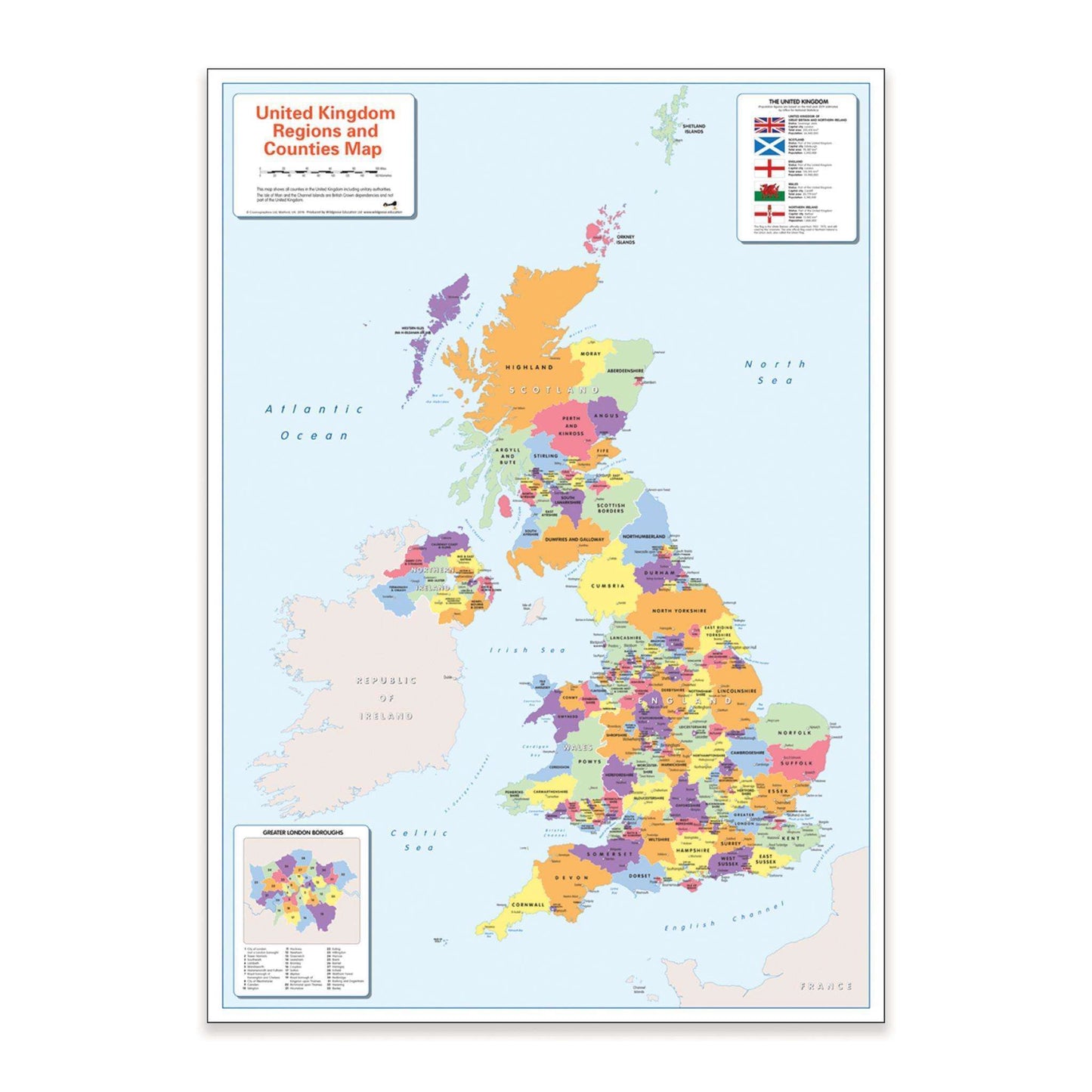
Colour Blind Friendly UK Political Map
Colour Blind Friendly UK Political Map
Regular price
£14.99 GBP
Regular price
Sale price
£14.99 GBP
Unit price
/
per
Tax included.
Shipping calculated at checkout.
Couldn't load pickup availability
A colourful, easy to read Colour Blind Friendly map showing the counties and regions in Britain and Ireland.
Teach or learn about our world with this colourful, easy to read children's world map showing the countries, counties, major cities and towns.
The map also includes the surrounding ocean and seas, Flags and information on the countries and a close up insert of the Greater London boroughs.
It is ideal for the home or classroom as our colours work for everyone, including those with a form of colour vision deficiency (CVD).
There is likely to be at least one child in every classroom that is colour blind.
Size: A1 (59 x 84cm)
Share